

mobileRIS.ro app for iPhone and iPad
Developer: Knowledge Design Unit
First release : 04 Dec 2014
App size: 22.54 Mb
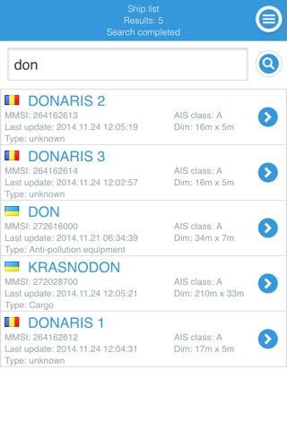
The Romanian mobileRIS.ro pilot application fully developed within IRIS Europe 3 project, provides quick and continuous access to River Information Services by means of mobile equipment. The application addresses all types of users interested in up-to-date and historical vessel positions provided by the Automatic Identification System, water level, weather condition, waterway shallow sections or other RIS related information. The mobile application connects to a set of web services that provide relevant RIS information made available by the systems managed by the Romanian Naval Authority and the Romanian Administration of the Lower Danube.
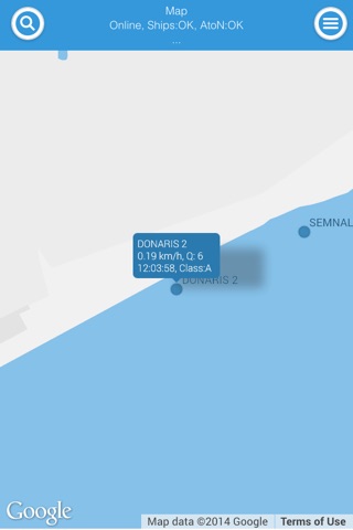
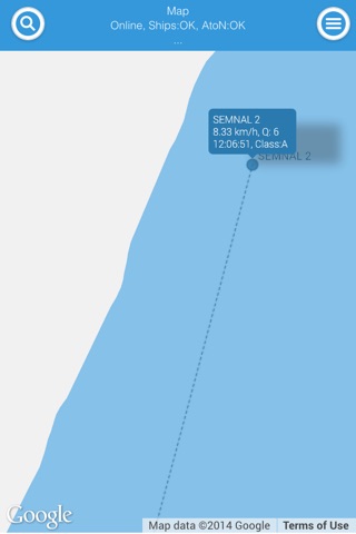
The up-to-date positioning data, which is displayed on top of a map service, covers the Romanian inland waterways as well as the coastal area of the Black Sea. The data displayed comes from class A and class B transponders as well as Aids to Navigation.
A 10 days track for each ship that navigated through Romanian inland waterways can be consulted in the application and users can navigate through the track positions step by step using the next and previous buttons or by moving the available slide bar. For each track position the time and speed are displayed.
The up-to-date positioning information and 10 days of vessel track are subject to authentication, which can be obtained from the Romanian authorities.
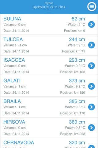
The application provides daily hydrological information for the Romanian inland waterways ports.
The shallow sections from the Romanian inland waterways are available and updated automatically when new information is available from the administration.
The mobile application provides the users with weather information and information related to the notices to skippers issued at national level.